HistoryGeologyCave FeaturesAmazing CavesCrystal Cave Homepage | ||
| In essence, karst topography is any region where the terrain has been dissolved by the physical and chemical weathering of the bedrock. These areas are composed of carbonate rocks, such as dolomite and limestone, or have a high concentration of evaporites, such as salt and gypsum, because these materials tend to be highly soluble in water. This high solubility causes the parent material to be highly susceptible to chemical weathering. Groundwater is typically slightly acidic and reacts chemically with subsurface rocks, especially those made up of highly soluble limestone. Surface flows in these areas are broken up by water being channeled into and underground system and flowing underneath the surface. At times this underground flow can remerge and continue above ground. Also large cave formations can appear in karst topography. | ||
| A cross-section of karst topography. The features can occur on or below the surface of the earth. | ||
| T | ||
A global map showing karst regions throughout the world. The green regions indicate area with a majority bedrock composition of limestone. The red regions indicate areas with active major karst topography. | A map of the United States showing regions displaying or having active karst topography. The green shading displays where karst regions are located. Karst topography is not cenralized to one spot, but it is spread out across the entire country. | A map showing locations throughout Wisconsin which have potential for karst topography. The yellow regions show areas where karst topography is capable within 5 feet of the surface. The blue shows karst potential between 5 and 300 feet. |
Different Types of Karst Formations/Topography | ||
On The Surface: Karst topography areas are found in almost every part of the world but are most dynamic and most likely to occur in humid environments. Humid climates allow for a greater quantity of flowing water. There are some noticeable differences between humid-temperate and humid-tropical environments. The humid-temperate climates are more likely to develop sinkholes, while humid-tropical climates are dominated by hills. The greater concentration of Calcite will most effectively determine the extent of karst. The picture above depicts typical karst topography in a humid tropical environment. Below the Ground: | ||
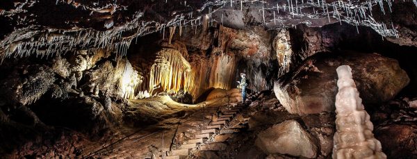
One of the more interesting features of karst topography is undoubtedly the limestone cave formations associated with large groundwater flows in Karst terrains. Caves are elongate cavities in limestone produced by solution and aided by mechanical erosion. They form along paths of greatest groundwater solution, usually along joint planes as water circulates through the fractures. Cave entrances and terminations can be found in the bottom of dolines, on hillsides, in quarries, at various other exposed locations. Cave passages can be determined in one of three ways, Linear, Angulate, and Sinuous. Linear is a straight linear passage with no change in ground level. Angulate is a passage consisting of sharp almost 90 degree changes in cave path, both up and down. Sinous is a curved path of very smooth changes in height. The cave pattern depends directly on the mode of groundwater recharge in the area. | ||
Unstable Land: No one lives forever 2 keygens. Karst Topography | Sink Holes Because the land beneath karst topography is very unstable, it has a tendency to become too fragile to support the surface, and will collapse, creating a sink hole. Sink holes make building or living on karst topography very dangerous. The ground beneath a building, home, or school could give way at any time, creating a dangerous hazard for people to live with. | |
| Often evident in theses landscapes is disrupted drainage networks where streams and rivers often cannot flow above ground continuously. As we saw at Crystal Cave in Spring Valley Wisconsin, the terrain was hummocky and exhibited drainage troubles. | ||
| A topographic map of a karst region. The area undulates greatly, creating a hummocky terrain. The red lines represent contour lines of 10 feet. The lines with perpendicular dashes are areas where there is a depression. With karst topography, these depressions are usually sinkholes. | ||
| A sinkhole in a densely populated area. Karst topography can be a dangerous location to live, as the bedrock of the area is slowly eroding away. This unstable land can cause massive sinkholes and other geomorphic hazards. | ||
Yamaha downloader for mac. David Speer | Bryan Vickroy |
- Why Does The Nps Actively Manage Cave And Karst Systems Of The World
- Why Does The Nps Actively Manage Cave And Karst Systems Of France
Why Does The Nps Actively Manage Cave And Karst Systems Of The World


Why Does The Nps Actively Manage Cave And Karst Systems Of France
Cave and Karst Management Plan EA (3.1 MB, PDF file) Disclaimer: Links within the above document(s) were valid as of the date published. Note: Some of the files may be in PDF format and can be viewed using the Adobe Acrobat Reader software. The Buffalo National River alone has more than 500 caves within its boundaries, making it one of the most cave-rich units in the National Parks. Karst systems are a type of topography that typically forms in contact with carbonate rock units of limestone and dolomite. Since its inception in 1907, the Florida Geological Survey has gathered data on Florida karst (sinkholes, caves, springs, etc.). This information is primarily used to more fully understand the unique relationship between karst and the state's groundwater resources and aquifer systems.
